Tornado Watch Issued for Putnam, Dutchess
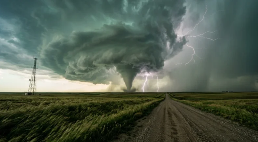
New York City and Northern New Jersey are under severe weather alerts, including a flash flood and tornado watches, impacting the evening commute.
A tornado watch was issued by the National Weather Service for several states, including Connecticut, Delaware, New Jersey, New York, and Pennsylvania, affecting approximately 32 million residents. The tornado watch will remain in effect until 9 p.m. local time.
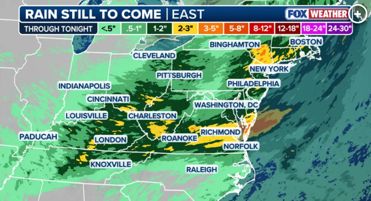
Heavy rainfall is expected, with rates of 1-3 inches per hour, forecasted to begin in the afternoon and continue into the night.
Residents in New Jersey, while not frequent hosts of tornadoes compared to Midwestern states, should be aware of the implications of a tornado watch, which is a preliminary alert indicating potential tornado conditions.
The alert differs from a tornado warning, which signifies imminent danger. Specific counties under the tornado watch include Dutchess, Putnam, Westchester, and others, while a separate flood watch is in place for Putnam County until 2 a.m. on Wednesday. Overall, the severe weather may cause disruptions, and residents are advised to stay informed about ongoing developments.

It advises:
- Know your safe location — ideally a basement or interior room.
- Know signs of a tornado, including but not limited to: dark or green skies; a rotating, funnel-shaped cloud; and loud or roaring sounds.
- Be ready to act quickly if the watch is upgraded to a warning, or you suspect a tornado is approaching.
The National Weather Service (NWS) will issue alerts for tornado sightings or indications of tornadoes on radar. In the event of receiving a tornado warning, individuals are advised to take immediate action.
The recommended safety measures include seeking shelter in a solid structure; if no shelter is available, it is safer to lie flat in a ditch or low-lying area, using hands to protect the head.
For those at home or in a building, going to the basement or an interior room on the lowest floor is critical, avoiding windows. Interior rooms like closets and bathrooms offer optimal protection; if possible, individuals should cover themselves with a sturdy object or mattress.
The tornado watch currently encompasses central and southeastern New York, including regions such as the Southern Tier, Catskills, Hudson Valley, New York City metropolitan area, and western Long Island. It also extends to much of New Jersey, eastern and central Pennsylvania, northern Delaware, and parts of western Connecticut.
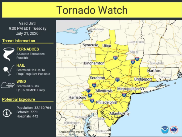
Due to the severe weather conditions, major airports have reported flight delays and cancellations, and there are warnings regarding potential flooding impacting highways and public transportation systems. The NWS indicated that a few tornadoes are likely, with scattered wind gusts potentially reaching 70 mph, alongside the possibility of storms producing hail as large as ping-pong balls.
When: date and start time
Tornado watches are not issued on a fixed schedule; they are released when atmospheric conditions are conducive for tornado development, generally forecasted ahead of or during severe thunderstorms.
In New Jersey, these conditions most frequently arise in late spring and summer, where warm, humid air interacts with cold fronts, although watches can occur in any season. The specific times for the start and end of a watch are included in the alert.
The Storm Prediction Center in Norman, Oklahoma, is responsible for issuing these watches, which tend to encompass several hours and cover extensive areas, such as “northern New Jersey” or “southern New Jersey,” potentially including multiple counties, even if the storm threat may only affect a smaller part of the region.
How to watch
To effectively monitor tornado watches in New Jersey, the National Weather Service (NWS) is the most reliable source. The state is served by two NWS offices: the New York office for North Jersey and the Mount Holly office for South Jersey and Philadelphia. Both offices provide real-time updates on watches, warnings, and radar imagery through their public webpages.
In addition to the NWS resources, residents can utilize several practical methods to stay informed about severe weather developments:
- Wireless Emergency Alerts: These alerts automatically send tornado warnings (not watches) to mobile devices located in affected areas.
- Local TV News Livestreams: Local news channels often interrupt regular programming to provide continuous coverage during significant weather events, especially when a watch is upgraded to a warning.
- NOAA Weather Radio: This dedicated radio service offers constant broadcasting of weather alerts, independent of cell service or internet connectivity.
- Weather Apps: Numerous weather applications provide push notifications based on specific locations, enhancing the user’s ability to receive timely information tailored to their immediate surroundings.
- Radar Maps: Utilizing radar maps during a tornado watch can be particularly beneficial, showing the formation and movement of storm cells, thus offering insight into potential timeframes for deteriorating conditions.
Employing these resources ensures that individuals remain well-informed and prepared for any impending severe weather events.
Prices and buying
The section discusses the cost dynamics surrounding tornado alerts, highlighting that there is no fee for receiving tornado watches or warnings, which are provided as a public safety service by the National Weather Service.
These alerts are disseminated at no charge through various channels such as wireless carriers, broadcast television, and radio. However, the text points out that expenses may arise from optional tools people use to enhance their severe weather tracking capabilities.
For instance, individuals might choose to invest in premium weather applications that offer hyperlocal radar, subscription-based storm-tracking software, or purchase a dedicated NOAA Weather Radio unit for home use, which typically involves a reasonable one-time cost. While these tools are not mandatory for staying informed, many households find the added details they provide to be beneficial during the active severe weather season.
The local angle
The local perspective for New Jersey residents regarding tornado preparedness often hinges on a straightforward inquiry: whether a tornado watch is currently in effect for their county.
Tornado watches, typically issued for expansive areas, mean that a county such as Bergen County might be encompassed in broader watches that extend across northern New Jersey and into sections of New York and Connecticut, even if significant storm activity remains distant.
Local emergency management offices frequently amplify National Weather Service (NWS) warnings via their social media and text alert systems, providing a valuable complement to these alerts.
This is particularly beneficial for receiving localized information regarding sirens, shelter instructions, or road closures resulting from storm damage.
Given New Jersey’s high population density and extensive network of highways, a tornado watch serves as an important cue for residents to prepare ahead of time, especially when driving. Being aware of appropriate routes and having a reliable means to pull over safely is crucial during the threat of severe weather.
What is worse for a tornado watch or warning?
A tornado warning is significantly more critical than a tornado watch. A watch indicates that conditions are conducive for tornado formation over a widespread area. In contrast, a warning signifies that a tornado has been confirmed, either through radar detection or observation by a trained spotter, and poses an imminent threat to a specific, localized area.
Consequently, individuals under a tornado warning are urged to take immediate shelter, as the situation is marked by active danger rather than mere possibility.
Staying safe during a tornado watch
Staying safe during a tornado watch involves proactive preparation, as a watch indicates the potential for a tornado but does not confirm that one will occur. It is crucial to use the time during a watch to take calm and measured actions rather than waiting for a warning.
Key measures to consider include selecting the most secure room in your home, which should ideally be an interior space on the lowest floor and away from windows.
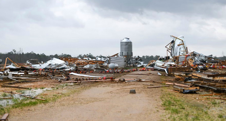
Additionally, it is advisable to ensure that your phone is charged in case of power outages, and to keep a battery-powered radio or flashlight within reach for emergency situations.
For individuals who are outdoors, at a stadium, or traveling when a tornado watch is issued, it is recommended to locate the nearest robust building in advance, as waiting until a warning is declared may not leave sufficient time to seek shelter.
Overall, preparation during a watch can significantly enhance safety and provide critical time to act effectively.
Pingback: Kendall County Tornado Warning: Tornado Watch vs Warning Explained as Severe Weather Threatens - internationalmediawire.com